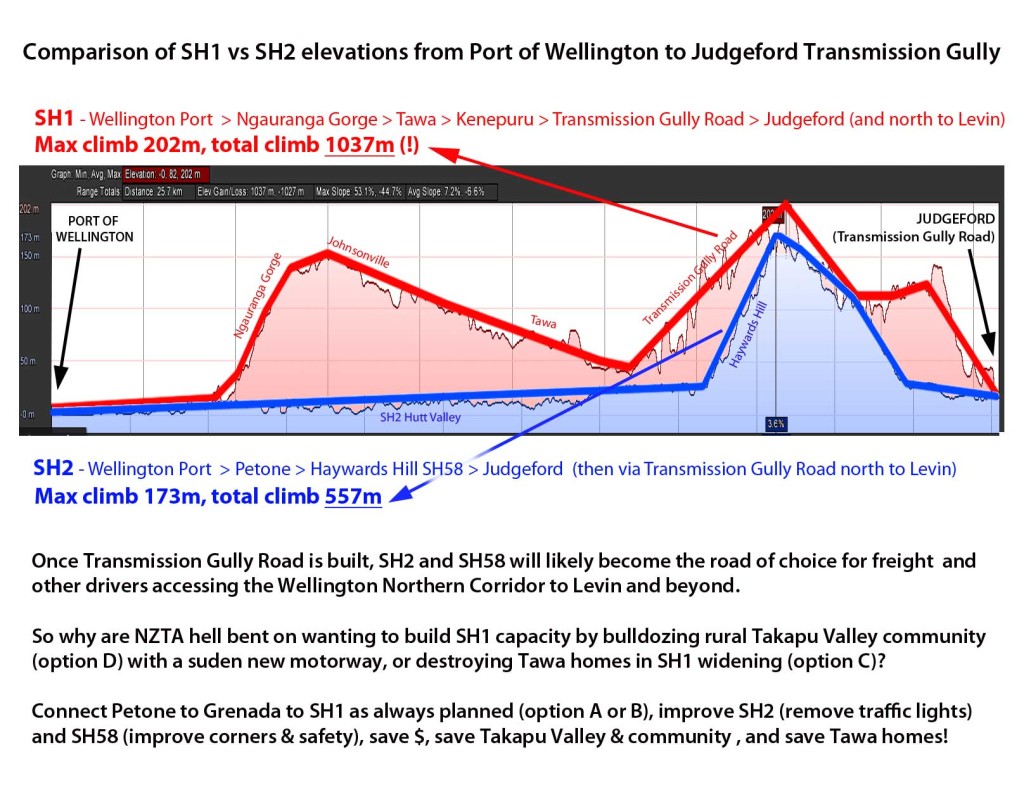
We were wondering what Transmission Gully Road would do to Wellington traffic flows once completed? Transmission Gully will shift the main Wellington northern corridor east, bissecting SH58 at Judgeford. What would this mean if you were a truck heading north from Wellington? Save for a few traffic lights on SH2, your route is clearly much better via SH2 and SH58 for fuel economy and wear and tear (see blue line below). So why are NZTA saying they need to invest $50-150m on extra capacity between Tawa and Porirua (SH1 widening or bulldozing rural Takapu Valley to make a ridiculous short parallel motorway), when for much less money they could remove traffic lights and fix a few bad corners on SH58?
These sudden proposals (options C and D) have arrived without Council knowledge and have totally circumvented the regional and district planning process. It’s clear to see that they’re being rushed through with haste by NZTA with no regard to wider regional needs. We say build Transmission Gully, and build Petone to Grenada Road if necessary, but wait to see what will happen before destroying communities and a whole rural valley.
NZTA tell us traffic volumes are going to miraculously skyrocket after Transmission Gully sending much more traffic past Tawa. We find this incredibly hard to imagine given traffic volumes have been dropping in Wellington, and when this elevation infographic diagram above suggests that Hutt Traffic (and possibly much Wellington Traffic) will prefer SH2/SH58 (over SH1 past Tawa) to Levin and beyond, further reducing flows.
Overall, this adhoc major infrastructure building by NZTA in road project silos is not serving the Wellington Region well. All these roads need to be put through a proper established strategic planning framework.

